Is there one best order of course topics? No. But some approaches are better than others. What should you consider when you outline your course?
Where this post came from
This post is a revised version of a contribution I made to a discussion on the ESPRIT List (a list serve for Earth science teachers). I highly recommend the list for middle and high school Earth science teachers - it's an engaging and friendly community. It also generates a lot of email, so I suggest setting up a filter in your email so it doesn't overwhelm your email in box. I don't read every message, but look for subject lines of interest and people I know who have interesting things to say.
The list is also archived, but access to the archives is password protected. If you're on the list, you can see the full discussion thread here (it's long, and gets a little too philosophical for even my tastes when you get into it).
What should you consider when you outline your course?
In the discussion on the ESPRIT list, a few folks noted that two things are key
- context (and systems), and,
- having a thoughtful rationale for your sequence. If you've thought through an argument for why you've chosen what you've chosen, it will probably work reasonably well, though getting input from the greater wisdom on the list will likely make it better.
Last time I taught the high school Earth science, I didn't think through the sequence well enough, and regretted it throughout the year. As mapping (a form of modeling) is central to nearly everything within the curriculum, it makes good sense to pay good attention to mapping and it's cross-cutting nature from the outset. I didn't. Oops.
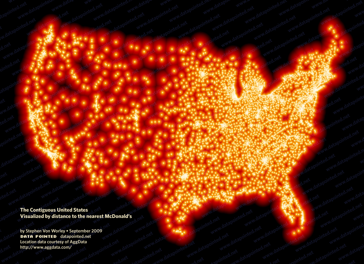
A couple of years ago, I put together a PowerPoint and webpage highlighting how topography is connected to many, many other things. I think it's quite striking how Idaho's Snake River Plain shows up on maps of nearly anything (like the distance to the nearest McDonald's in the map below). The connection of the shape of the land to so many other things is a also a good way to introduce the idea of Earth systems science.
If I were back in the classroom, I'm not sure if I'd start with astronomy or the shape of the Earth, but it would likely be one of those two. Both of them provide good opportunity to really highlight the importance of understanding place and understanding how to map. In either case, I'd start with a focus on where we are.
I'll also note that mapping is really a pretty big abstraction, and I was surprised by how many of my high schoolers didn't really know what a map was. A significant minority of my 10th graders couldn't locate Buffalo on an unlabeled map of New York (despite having lived there all their lives) or New York on an unlabeled map of US states. In a sense, that shouldn't be surprising, especially if you're working with kids who've not travelled much. Think about the conceptual leap of looking at a piece of paper and translating that into showing where you are on the surface of Earth!
After realizing how many kids weren't able to place themselves on a map, I used Google Earth to recreate the classic Eames' film, Power of Ten centered on the school. (If you've not seen it, you need to click that link!). In the ReaL Earth Inquiry Project (an NSF funded program now in its final months) we put together tutorials for making your own Powers of Ten, centered on your school or a local landmark. Again, if I were back in the classroom, I'd show that in the first few days of school - for some kids in my class, you could almost see the light bulbs go on as they realized for the first time what a map really was, and recognized where in the world they were. Aspects of every unit play out outside your classroom door in some meaningful way, so grounding your students in where they are is something that you can connect to across the curriculum.
Throughout the year, I'd also draw attention to big ideas that cut across the entire curriculum. This could be in the form of the Crosscutting Concepts and Science and Engineering Practices from the Next Generation Science Standards, or the set of Bigger Ideas we've been using in the ReaL Earth Inquiry Project.
I'll also echo Glenn and Wendy's thoughts on coordinating across the team of teachers. You might consider having different teachers take leads on different topics, allowing for more development than individuals can give. Hopefully, that can help to give the curriculum a focus on what's local to the school. I know, of course, that that working well depends on who's on your team.